


The Kerbol system as of 12/14/15
The KSA Flight Tracker is an interactive web application that can show you details about every vessel the Agency has ever launched and is currently operating. Some of the major features of the Flight Tracker include:
- Dynamic Surface Maps – when available, you can pan and zoom to see surface detail of the planet the craft is currently orbiting, similar to Google Maps. The vessel’s orbital path is plotted along the surface.
- Real-time orbital data – all active vessels will have available their current altitude, latitude, longitude and speed that is updated once per second. You can also see how long until the vessel reaches apoapsis or periapsis along its orbit.
- 3D vessel views – where available, you can switch off the default 2D image of the vessel and view the vessel in 3D, which allows you to pan, zoom and rotate to view the entire craft.
- Launch telemetry – not available for many older craft, but more recent vessels have 12 telemetry data points updated every 15s during ascent. Even more recently we have upgraded this system to provide 18 data points updated at up to 30FPS during ascent
- Archived data – you can page back through events to see every major aspect of the mission from when it was first given a launch date. Each vessel also has its own collection of tweets that give you a more detailed look at its history since its first inception
- Upcoming maneuvers – if the vessel has a maneuver node scheduled it will appear on the dynamic map and contain information about the maneuver such as time and Δv required
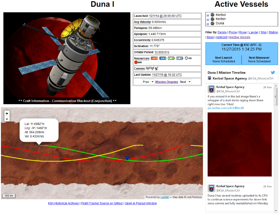
Example flight tracker page